Over the past week in Orlando, Florida, the region has been encountering arid and dusty air originating from the Sahara. This condition has led to moderate opportunities for rain, impacted the quality of air, and produced striking sunrises and sunsets.
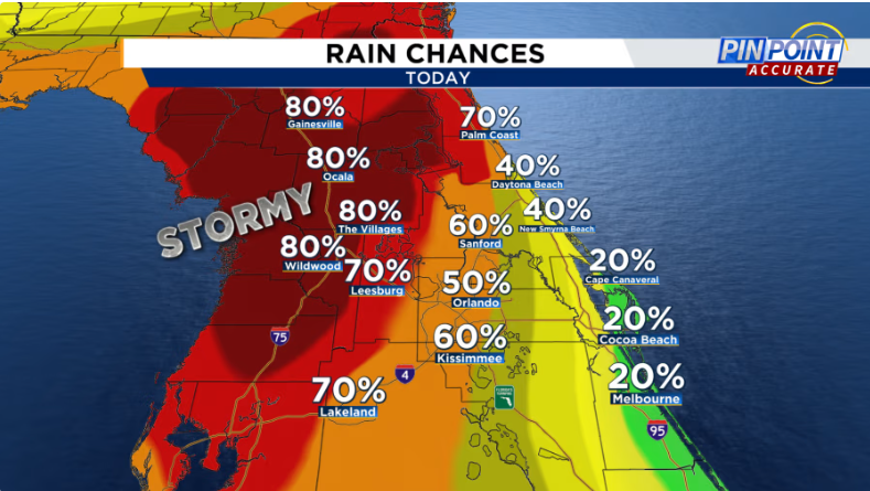
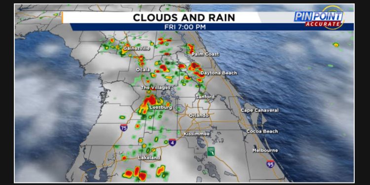
As we move towards the end of the week, there is good news for those affected by poor air quality. The dust is expected to clear on Friday, bringing relief to some areas. Moreover, there is a 50% chance of rain in the metro area, with even higher chances in western counties. Despite the rain, temperatures are expected to remain high, with afternoon highs in the mid-90s, making it feel like 105-107°. We can expect a mix of sun and clouds throughout the day.

After 3 p.m., we can anticipate the emergence of showers and thunderstorms, some of which may bring about heavy rainfall, gusty winds (ranging from 30-40 mph), and lightning strikes.
As we head into the weekend, there is a good chance of rain with a probability of 60-70%. This is great news for Central Florida, which has been experiencing a dry spell lately. However, it won’t be a complete downpour, but rather a refreshing soaking for many cities. The temperatures will remain in the mid to upper 90s during the afternoon, making it feel like triple digits.
TROPICS:
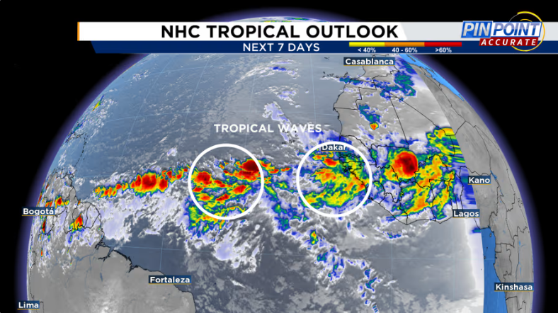
Over the next 8-14 days, there is a possibility for some tropical waves originating from the coast of Africa to organize in the eastern tropical Atlantic. However, this is dependent on whether they can make it through the Saharan dust.
Over the course of the next week, it’s doubtful that there will be any development in the Atlantic basin due to the current MJO phase and Saharan dust. Nonetheless, according to long-range Euro models, there is a possibility of some development in early August, mainly in the western Atlantic, northern Caribbean, and potentially near Florida.

According to the Euro models, there is a chance for development, but the GFS models indicate that there will be no development.
The future remains uncertain, but this provides a glimpse of what may lie ahead.
According to the latest update on Friday morning, there are no areas of concern highlighted by The National Hurricane Center.
